 Google Earth 7.1.2.2019
Google - (Freeware)
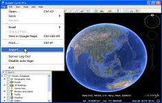
View 3D Earth, 3D representations of monuments, buildings, stars and satellites or just study the interactive globe with the amazing application called Google Earth.
Google Earth is a virtual globe that can be used to view the images recorded by satellite from most places in the world.
By entering the place to visit in the search, the application leads the user from space or a few meters above the ground, directly to destination. The accuracy of the photos is amazing.
Globe handling is very intuitive, being possible to orient the camera to rotate, move and naturally enlarge the image.
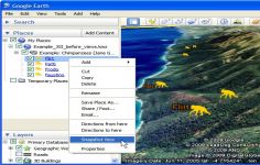
Additional information can be overlaid on the satellite image, such as hotels, restaurants, roads, etc.
Google Earth is entirely in 3D, relief areas (land and sea) and the buildings are also apparent.
It is possible to annotate the map, send a satellite photo by e-mail or to make measurements to the nearest centimeter. Google Earth is now linked to Google Maps with a single click and user can also vary the lighting of a place based on time.
The application offers the possibility to connect a GPS to view the route and take advantage of specific data such as elevations, speed, etc.
- Title:
- Google Earth 7.1.2.2019
- File Size:
- 24.3 MB
- Requirements:
- Windows 2000 / XP / Vista / Windows7 / XP64 / Vista64 / Windows7 64 / Windows8 / Windows8 64
- Language:
- en-us
- License:
- Freeware
- Date Added:
- 24 Sep 2013
- Publisher:
- Homepage:
- http://www.google.com
- MD5 Checksum:
- 2BD8F31804D5C9F4B5A882F3D76BA89C
# Issues fixed :
* The Enable Controller option in user preferences is now turned off by default. This prevents red directional arrows from displaying as a result of uncalibrated joysticks and other controllers being connected to Earth at startup.
* For enhanced security, Use HTTPS for Google connections is now toggled on by default.
* fixed a bug whereby the cache size rose above user-specified limits.
* fixed a crash resulting from searching on some Windows machines.
* updated the LEAP API to version 1.08.
* reduced LEAP controller sensitivity to user hand motions. This enables a smoother flight and greater control over your flight path when using a LEAP.
Related software
2.4/5 from 193 users


